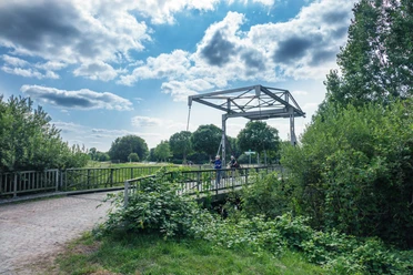
Barßler Hafen


- 3:30 h
- 57.09 km
- 11 m
- 11 m
- 1 m
- 11 m
- 10 m
- Start: Westerstede, Barßel, Ocholt
- Destination: Westerstede, Barßel, Ocholt
Over about 58 kilometers, this route offers lots of variety. It goes through forests, pasture areas, various moors along some beautiful watercourses and lakes. With the Howieker Watermill in Ocholt and the impressive Ebkensche Mill in Barßel, there are also two mills on the possible sightseeing program. The destination is Barßel, an old fishing and shepherding village that changed into a peat-cutting village under the Oldenburg raids in the 16th century and had to join the fen system.
Highlights:
- The Howiek Watermill was built in 1608 with the approval of Count Anton Günther and was only shut down in 1908. Notable is the half-timbered building with a saddle and tiled roof. It was driven by an undershot water wheel.
- Lake "Drakamp Schlatt": On the edge of the Godensholter Tief nature reserve lies the roughly two-hectare Drakamp Schlatt, formed in a blowout hollow and designated as a natural monument. The schlatt is continuously surrounded by shrubs.
- The Ebkensche Mill is a three-story tower mill with a wind rose from 1892. The mill has three grinding decks, two for crushing and one for flour production.
- Barßel Harbor: After straightening and diking the Soeste in the mid-1950s, the river-adjacent part of Barßel changed. However, the village still retains the character of a seafaring village, especially because in the 1970s a new harbor for recreational boats was built on the western bank of the Soeste. From here, the Soeste can be explored aboard the "MS Spitzhörn."
- Agricultural Museum Behlen in Lindernerfeld, a rich collection passionately assembled of various common agricultural tools from the "good old days"

Good to know
Best to visit
Directions
Equipment
Directions & Parking facilities
A28 / A29 / A31
Your arrival by car takes place along the motorways A1 and A29 to Oldenburg, and from Oldenburg further along the A28 towards Emden/Leer to Westerstede or your desired destination in Ammerland.
You can conveniently arrive by train at the following stations in Ammerland and the region.
Stations: Leer, Augustfehn, Westerstede-Ocholt, Bad Zwischenahn, Oldenburg, Rastede
The other towns and districts can be easily reached by bus.
Additional information
Round trips with the MS Spitzhörn from Barßel Website: http://www.barssel-saterland.de/die-ms-spitzhoern/
License (master data)

Author´s Tip / Recommendation of the author
- The "Barßeler Imbiss" directly at the church with Dutch specialties and a changing lunch menu
- The listening station at the Howieker Watermill
Safety guidelines
Map
Nearby


Download GPX file