Aueweg


- 1:53 h
- 7.86 km
- 6 m
- 6 m
- 5 m
- 10 m
- 5 m
- Start: Kurverwaltung Bad Zwischenahn, Auf dem Hohen Ufer 24
- Destination: Kurverwaltung Bad Zwischenahn, Auf dem Hohen Ufer 24
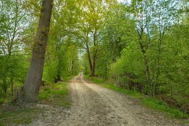
We start at the Rathausplatz in Bad Zwischenahn. From there you walk a bit through the town past the bathing park. You soon reach the floodplain. After crossing the Auetunnel you get a view of a renatured oxbow lake and of the Auewehr. The weir system was built in 1977 by the Ammerländer Wasseracht as part of the expansion of the floodplain and flood protection in the Leda-Jümme area. In the event of a flood, the water level in the Zwischenahner Meer can be raised by up to 60 cm (this corresponds to a water volume of approx. 3.3 million m³). Due to the old arm, which was renatured in 2007 and which flows around the weir system, among other things again fish get into the Zwischenahner Sea and its tributaries. If you walk further you will find yourself in a tunnel made of trees, which shields the traffic noise of the main street. After a while the landscape opens up and you can look out over wide meadows with grazing cows, while you enjoy the quiet splashing of the floodplain and take a short rest on a bench. In the further course you leave the river and turn left. Here you can see the grounds of the Lengert tree nursery, just before Ekern. Then you walk through the cozy housing estate on the Busch and cross a main street before you reach the Wiesengrund. This is another beautiful place to stop under trees. There are enough benches here. The further way leads through a small housing estate and through the Bäketunnel. After a short time you will reach Bad Zwischenahn again, where you can relax in one of the cafés. The last part of the route runs parallel to the sea, you can see, among other things, the old spa house built in 1874. Otherwise you can enjoy the great view of the sea with many small sailing ships and the white fleet. At the end of the hiking trail you are back on the Rathhausplatz next to the St. John's Church, built in 1124, and the bronze catfish, which, according to legend, was spotted in the Zwischenahner Meer between the 1970s and 1980s.

Good to know
Best to visit
License (master data)

Nearby


Download GPX file